
Everything connected. From arrival to destination.
One system for mapping, navigation, property information, and the services people depend on.
MCB brings indoor and outdoor environments together through interactive maps, connected navigation, and the tools organizations need to manage their locations.
From a single building to an entire portfolio, our five integrated services provide a common foundation for visitors, operations, and commercial activity.
Discuss Your ProjectFind any destination. Indoors or out.
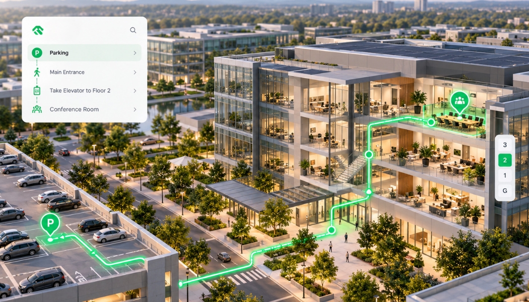
A visitor shouldn't need one map to find the property, another to find the building, and someone at the front desk to find the right floor.
MCB connects these parts of the journey through one interactive mapping experience.
Explore buildings in 2D or 3D. Find entrances, departments, stores, services, parking, and transportation. Follow routes between outdoor spaces and indoor destinations.
What it includes
Interactive 2D & 3D Maps
Present buildings, floors, pathways, and destinations in a clear visual environment.
Indoor & Outdoor Wayfinding
Connect arrival points, pedestrian routes, building entrances, elevators, and individual destinations.
Accessible Navigation
Provide routes using verified accessible entrances, pathways, ramps, and elevators.
Parking & Transportation
Connect parking facilities, public transit, shuttle services, and pedestrian access with the places they serve.
Searchable Destinations
Find rooms, departments, tenants, amenities, services, and points of interest through a unified directory.
Mobile & On-Site Access
Make approved location information available through websites, mobile devices, QR codes, and compatible digital signage.
Where it works
Healthcare campuses, universities, shopping centers, government buildings, transit stations, hotels, resorts, convention facilities, and mixed-use developments.
One journey. One map.
Keep the map as current as the property.
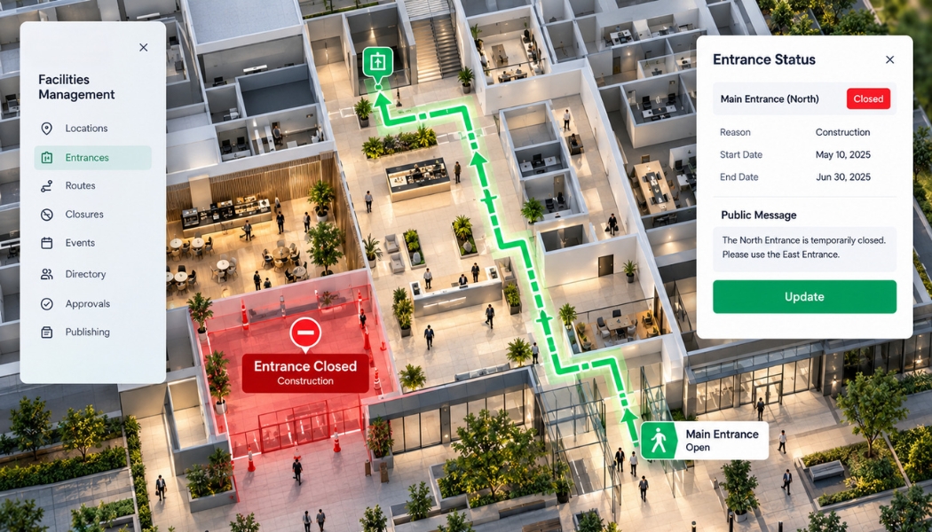
A department moves. An entrance closes. A tenant changes. A pathway becomes temporarily unavailable.
The people relying on the map still need accurate directions.
MCB connects navigation with the information and administrative processes required to maintain it throughout the property's operating life.
What it includes
Location & Directory Management
Maintain buildings, floors, departments, tenants, services, amenities, and destinations.
Route & Access Updates
Manage approved entrances, closures, detours, accessibility information, and temporary restrictions.
Administrative Controls
Give authorized personnel responsibility for the information they manage, with appropriate permissions and publishing controls.
Event & Schedule Information
Connect approved schedules, event destinations, service information, and temporary activities to relevant locations.
Information Consistency
Coordinate destination and route information across supported maps, directories, kiosks, and connected interfaces.
Ongoing Support
Maintain the system as properties expand, departments relocate, and operational needs evolve.
A practical example
An entrance closes for construction.
The affected navigation information is reviewed, the available entrance is identified, and approved changes are published to the relevant map and routing interfaces.
Visitors receive directions based on the current access arrangements rather than an outdated floor plan.
One standard. Every property.
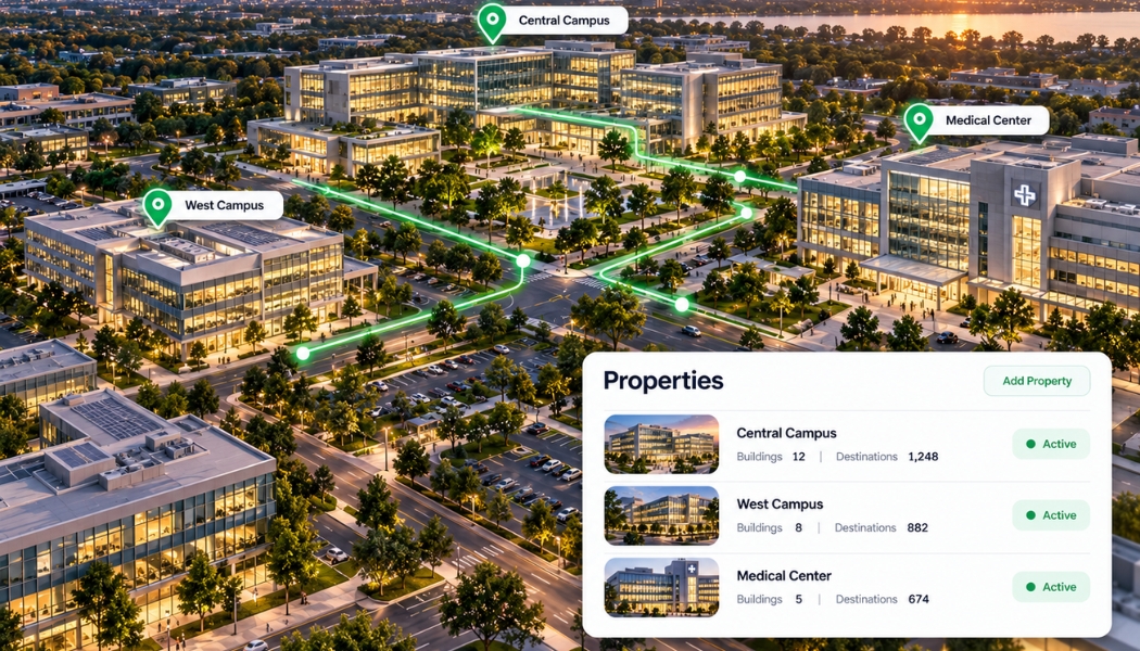
Organizations operating multiple buildings or locations need consistent information without losing control of what happens at each property.
MCB establishes a shared mapping and administration framework that supports individual locations within a common enterprise system.
What it includes
Multi-Property Mapping
Connect buildings, campuses, facilities, and destinations through a consistent spatial structure.
Centralized Administration
Manage approved information across participating properties with appropriate local and enterprise-level permissions.
Existing System Integration
Connect available information from property databases, facilities platforms, scheduling systems, transportation feeds, and other authorized resources.
Data Preparation & Validation
Organize existing plans, floor information, location records, and operational data for reliable use.
Staff Training & Onboarding
Provide the documentation and training required for designated personnel to maintain their responsibilities.
Managed Deployment & Support
Coordinate implementation, testing, ongoing maintenance, and expansion across locations.
Built for the organization behind the property.
A healthcare system may operate multiple hospital campuses. A university manages dozens of academic and administrative buildings. A property owner oversees a portfolio of commercial developments.
Each location has its own requirements.
The information standards, administrative responsibilities, and core platform do not need to be rebuilt from the beginning at every site.
Connect people with the businesses around them.
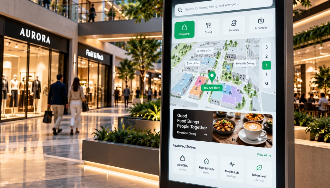
A property map can do more than show where a business is located.
It can connect tenants, amenities, services, events, and relevant commercial information with the people already navigating the property.
MCB brings commercial destinations into the same mapping environment used for visitor navigation and property information.
What it includes
Tenant & Business Directories
Maintain searchable business locations, descriptions, categories, and relevant services.
Destination Discovery
Connect visitors with shops, restaurants, amenities, attractions, and other participating destinations.
Commercial Information
Present approved business details, services, events, and relevant visitor information at their corresponding locations.
Sponsorship & Promotional Placements
Support designated placements within authorized digital property experiences.
Campaign Administration
Provide a foundation for managing approved commercial placements, schedules, and participating businesses.
Commercial Reporting
Support appropriate reporting on advertising delivery and interaction with authorized commercial information.
A foundation for ongoing commercial activity.
Tenants change. Businesses introduce new services. Events bring different audiences to a property.
A maintained spatial directory provides a common place to manage this information alongside navigation.
For eligible properties, this foundation can support additional advertising-management services as the commercial network develops.
Commercial capability development
Expanded advertising-management services are being developed toward the planned 2028 rollout. Availability and inventory rights are established separately for each participating property.
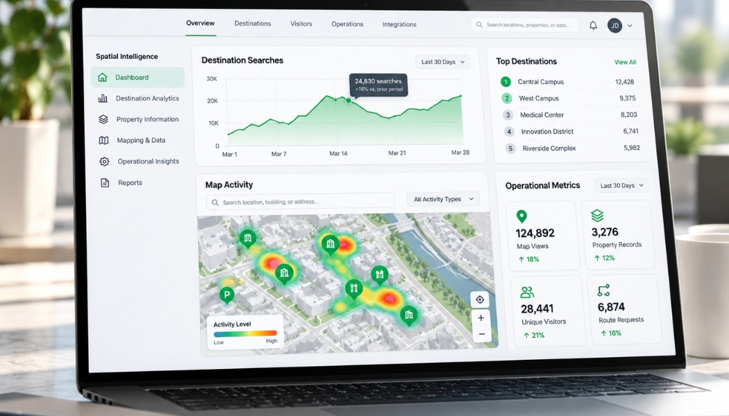
Turn location information into operational knowledge.
Maps show where things are.
The information behind them can also reveal what visitors are searching for, which destinations are frequently requested, and where property information requires attention.
MCB connects spatial data with available operational information so organizations can manage their environments with greater visibility.
What it includes
Mapping & Destination Analytics
Understand map usage, destination searches, and interactions with available location information.
Operational Reporting
Review location updates, administrative activity, and relevant information-maintenance metrics.
Data & System Integrations
Connect approved spatial and operational information through compatible APIs and other supported interfaces.
Multi-Site Visibility
Review relevant spatial and operational information across participating properties.
Advanced Indoor Positioning
Evaluate qualified positioning technologies for applications requiring additional location awareness.
Location-Aware Services
Support approved experiences associated with destinations, property information, and applicable positioning capabilities.
Useful information. Connected to the location.
For a hospital, that may mean understanding which destinations patients search for most often.
For a shopping center, it may mean understanding directory usage across different areas of the property.
For a campus, it may mean identifying destinations that require clearer information or route verification.
The purpose is to make existing spatial information more useful to the people responsible for maintaining the environment.
Connected applications
More than a map.
The same MCB platform can support specialized applications across different properties, audiences, and operating requirements.
Visitor & Destination Services
Transportation & Access
- Parking and pedestrian navigation
- Shuttle and public transportation information
- Accessible routes and entrances
- Building-to-building connections
- Temporary access changes
Commercial & Institutional Operations
These applications can be configured individually or combined within a broader enterprise implementation.
How we work
From the first property to the entire portfolio.
Assess
Understand the buildings, destinations, operating requirements, existing systems, and information that need to work together.
Connect
Establish the mapping foundation, navigation requirements, location information, and approved integrations.
Deploy
Configure the user experience, administrative tools, property information, and supporting workflows. Validate the system in the physical environment.
Maintain
Keep the map and its connected information accurate as locations, services, and operational conditions change.
Expand
Extend the same infrastructure to additional properties, operational systems, and approved commercial applications.
Where can MCB take you?
One building. A connected campus. A commercial property. An entire destination.
Tell us what needs to be mapped, how people need to navigate it, and what your organization needs to maintain.
We'll establish the right starting point.
Discuss Your Project